MarktPlaza

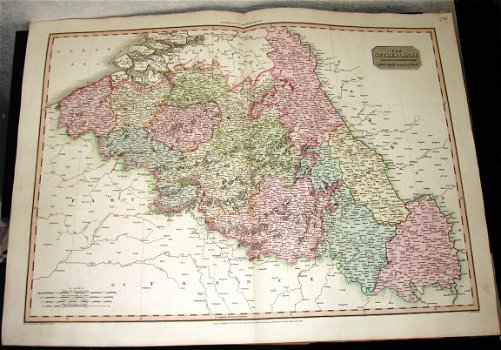
K17 Kaart Netherlands & Countries to the Left Bank of the Rhine 1810 Neele

181x bekeken
10 jaar geleden geplaatst

Kenmerken

Conditie
Gebruikt
Levering
Niet van toepassing

Omschrijving

Kaart The Netherlands and the Countries to the Left Bank of the Rhine. Neele Sculp. London. Published 1st september 1810 by Cadell & Davies Strand , & Longman Hurst, Rees & Orme, Paternoster Row. Neele sculp. Verschenen in Pinkerton's Modern Atlas.

Formaat ongeveer 57 x 76 cm (hxb). Achterzijde niet bedrukt. Kaart grotendeel in kleur. Oude kaart van België met ruime marges. Referentienummer K17.

125 euro

Als u biedt is dat exclusief verzendkosten (6,95 euro als pakketje). Afhalen is ook mogelijk op afspraak. Zie ook mijn andere advertenties.